NORTH CAROLINA
AHOSKIEHertford County - North Carolina Division of Forest Resources
|

|
AIR BELLOWSAlleghany County - North Carolina Division of Forest Resources
|

|
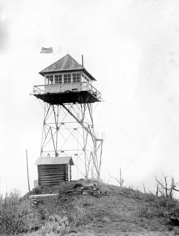
ALBERT MOUNTAINMacon County - Nantahala National Forest
|

|
ANDERSON MOUNTAINCatawba County
|

|
ANSONVILLEAnson County
|

|
APEXWake County
|

|

BANNERMANPender County
|

|

BARNETT KNOBSwain/Jackson County
|

|

BAYLEAF -1 (PRE-1968)Wake County
|

|

BAYLEAF - 2 (POST-1968)Wake County
|

|

BEARWALLOW MOUNTAINHenderson County
|

|

BEAVERDAM BALD |

|

BELCROSSCamden County - North Carolina Division of Forest Resources
|

|

BENN KNOBCleveland / Burke Counties
|

|

BIG KNOBMadison County
|

|

BIG STAMPCherokee / Clay Counties - Nantahala National Forest
|

|

BIGGERSTAFF MOUNTAINRutherford County - North Carolina Division of Forest Resources
|

|

BLACK SWAMPJones County - Croatan National Forest
|

|

BOLIVIABrunswick County - North Carolina Division of Forest Resources
|

|

BOONEWatauga County - North Carolina Division of Forest Resources
|

|

BUCK MOUNTAINMontgomery County - Uwharrie National Forest
|

|

BUTNERGranville County
|

|

CAMERON HILLHarnett County - North Carolina Division of Forest Resources
|

|

CAMPHertford County
|

|

CAMP CREEK BALDMadison County - Pisgah National Forest
|

|

CAMP PARRYDICE |

|

CANE MOUNTAINAlamance County
|

|

CARTER TOPJackson County
|

|

CARTHAGE COURTHOUSEMoore County - North Carolina Division of Forest Resources
|

|

CAROLINA HOTEL (PINEHURST)Moore County
|

|

CASWELL COUNTYCaswell County - North Carolina Division of Forest Resources
|

|

CATHERINE LAKEOnslow County - North Carolina Division of Forest Resources
|

|

CEDAR CREEK
Cumberland County - North Carolina Division of Forest Resources

1934: A 99-foot 9-inch steel tower constructed by the CCC.

CHADBOURN
Columbus County - North Carolina Division of Forest Resources
|

|

CHAMBERS MOUNTAIN
Haywood County - North Carolina Division of Forest Resources

1934: A 45-foot 9-inch steel tower was erected by the CCC.

CHERRYVILLE
Gaston County

CHESAPEAKEGates County - North Carolina Division of Forest Resources
|

|

CHESTNUT MOUNTAINAvery / Burke / Caldwell Counties
|

|

CHINQUAPINDuplin County - North Carolina Division of Forest Resources
|

|

May 1936: The erection of a 99-foot 9-inch steel tower was begun by the Civilian Conservation Corps, the $1,877.93 cost was covered by funding through the Emergency Conservation Works program. (Department of Conservation and Development - 6th Biennial Report 1934-36)
1961: The lease on the site had expired. The State purchased the land during the summer. (Department of Conservation and Development - 19th Biennial Report - 1962)

CHOWAN
Chowan County - North Carolina Division of Forest Resources

CLARKTON
Bladen County - North Carolina Division of Forest Resources

1941: A 120-foot tower was erected by the CCC. (Department of Conservation and Development - 9th Biennial Report - 1942)

CLAYTON
Johnston County

CLINGMANS DOMESwain County
|

|

CLINTON
Sampson County - North Carolina Division of Forest Resources

1937: A 120-foot wood tower was erected by the CCC.
September 15, 1938: [CCC] "31' x 25' 4-room frame house at Clinton tower in Sampson County; completed September 15, 1938 by Camp P-68." (Department of Conservation and Development - 8th Biennial Report - 1940)

COLUMBUSTyrrell County - North Carolina Forestry Service
|

|
1946: A 120-foot tower erected by the State Forestry Service. (Department of Conservation and Development - 11th Biennial Report - 1936)

COMFORT
Jones / Onslow Counties - North Carolina Division of Forest Resources

1936: A 99-foot 9-inch steel tower was erected by the Civilian Conservation Corps, the $2,001.33 cost was funded through the Emergency Conservation Works program. (Department of Conservation and Development - 6th Biennial Report 1934-36)

CORBIN MOUNTAINHenderson County
|

|

COVINGTON MOUNTAIN
Stokes County - North Carolina Division of Forest Resources

COWEE BALD
Jackson County - Nantahala National Forest
|
Not dated - (USFS) D.H. Ramsay Library, Special Collections, UNCA
|

CROATAN
Craven County - Croatan National Forest
1928-30: A 100-foot steel tower was erected. (Department of Conservation and Development - 3rd Biennial Report 1928-30)

DAVES MOUNTAIN
Randolph County - North Carolina Division of Forest Resources

DEPPE
Onslow County - North Carolina Division of Forest Resources (Hofmann State Forest)
|
no date - Special Collections Research Center at NCSU Libraries
|

1938: A 120-foot creosoted wood tower was constructed by the CCC at Camp S-65. (Department of Conservation and Development - 7th Biennial Report - 1938)

DEVILS NEST
Mitchell County - U.S. Forest Service

DIXONOnslow County - North Carolina Division of Forest Resources
|

|

DUCKETT TOP
Madison County - North Carolina Division of Forest Resources / U.S. Forest Service

DUDLEY
Wayne County - North Carolina Division of Forest Resources

September 1934: The Civilian Conservation Corps constructed a 99-foot 9-inch steel tower with a 2-room tower house for a cost of $1,745.66. The costs were covered by the Emergency Conservation Works program. (Department of Conservation and Development - 6th Biennial Report 1934-36)

DUGGER MOUNTAINWatauga County - North Carolina Division of Forest Resources
|

|

DUKE CHAPEL TOWERDurham
|

|

DUNN MOUNTAINRowan County - North Carolina Division of Forest Resources
|

|

EAGLE SPRINGS
Moore County - North Carolina Division of Forest Resources
1944: A 120-foot tower was erected.

EARP
Johnston County - North Carolina Division of Forest Resources
1936: A 102-foot steel tower was erected. A cooperator purchased the tower and was erected by ECW labor the cost to the State was $45 and the ECW costs were $349. (Department of Conservation and Development - 6th Biennial Report 1934-36)

EAST LAKEDare County - North Carolina Division of Forest Resources
|

|

EAST ROBESON
Robeson County - North Carolina Division of Forest Resources > East Howellsville Volunteer Fire Department

February 1935: The Civilian Conservation Corps erected a 99-foot 9-inch steel tower with a 2-room ground cabin for the cost of $1,714.68. The funding was through the Emergency Conservation Works program. (Department of Conservation and Development - 6th Biennial report 1934-36)
1993: "Requested by: Representatives DeVane, Bowman, Nesbitt, Diamont, Senators Daniel, Plyler, Kaplan
FIRE TOWER TRANSFER
Sec. 115. Notwithstanding the provisions of G.S. 146-74, the Division of Forest Resources, Department of Environment, Health, and Natural Resources, shall transfer in fee simple by gift the East Robeson Fire Tower and approximately .91827 acres of land on which the tower is located approximately eight miles east of Lumberton on Highway 41 in East Howellsville Township, Robeson County, this being the property described in the deed dated March 7, 1935, and recorded in Deed Book 8-N, page 219, Robeson County registry to the East Howellsville Volunteer Fire Department, Inc. The transfer under this section shall be evidenced by a deed executed in accordance with G.S. 146-74 and registered in accordance with G.S. 146-74." (Session laws and resolutions passed by the General Assembly [1993])
January 2014: Government auction for surplus property: the 99'9" steel tower and the nine-tenths of an acre the tower is located are being sold at auction. The closing date is January 28, 2014. The winning bid total, plus fees, was $8,922.50.

EDGECOMBEEdgecombe County
|

|

ELIZABETHTOWN
Bladen County

ELLERBE
Richmond County - North Carolina Division of Forest Resources

1934: A 59-foot 3-inch steel tower constructed by the CCC.

ENGELHARDHyde County
|

|

EVERETTSBeaufort County - North Carolina Division of Forest Resources
|

|

1936: The Civilian Conservation Corps erected a 99-foot 9-inch steel tower.

FAYETTEVILLE, CITY WATER TANK
Cumberland County
1930-32: A temporary lookout station was posted atop the City water tank. (Department of Conservation and Development - 4th Biennial Report 1930-32)

FERRIN KNOB
Buncombe County - Pisgah National Forest

FIRE TOWER #1 (near Duck Creek)
Onslow County - MCB Camp Lejuene

FIRE TOWER #2 (near Sneads Ferry Bridge)
Onslow County - MCB Camp Lejuene

FIRE TOWER #3
Onslow County - MCB Camp Lejuene

FIRE TOWER #4
Onslow County - MCB Camp Lejuene

FIRE TOWER #5
Onslow County - MCB Camp Lejuene

FIRST NATIONAL BANK BUILDING
Wilson County
1930: "During the spring fire season a temporary map stand worked up by D-4 is being used on the buildings that are serving as temporary lookout points." (Department of Conservation and Development - 3rd Biennial Report 1928-30)

FLAT TOP MOUNTAIN
Watauga County

FOREMANMartin County - North Carolina Division of Forest Resources
|

|

FOUNTAINEdgecombe County - North Carolina Division of Forest Resources
|

|

FOX MOUNTAINIredell County
|

|

FREMONT
Wayne County

FRYE MOUNTAINSwain County - Nantahala National Forest
|

|

FRYINGPAN MOUNTAINHaywood County - Pisgah National Forest
|

|

GIDDENSVILLE
Sampson County - North Carolina Division of Forest Resources

1942: A 120-foot tower was erected by the CCC. (Department of Conservation and Development - 9th Biennial Report - 1942)

GLOVER (BAILEY)Nash County - North Carolina Division of Forest Resources
|

|

GORDON MOUNTAIN
Anson County - North Carolina Forest Service
1947: A 99-foot 9-inch tower was erected by the State Forestry Service. (Department of Conservation and Development - 12th Biennial Report - 1948)

GRANTSBOROPamlico County - North Carolina Division of Forest Resources
|

|
1947: A 120-foot tower was erected by the State Forest Service. (Department of Conservation and Development - 12th Biennial Report - 1948)

GRASSY MOUNTAIN
Mitchell County

GREEN KNOB
McDowell County - Pisgah National Forest
April 20, 2013: A dedication ceremony, celebrating the restoration of the tower, was held at the Green Knob Fire Tower with speakers and featuring a tour of the tower.

GREENS CROSS
Bertie County - North Carolina Division of Forest Resources

August 1934: The Civilian Conservation Corps constructed a 99-foot 9-inch steel tower and a 2-room cabin for a cost of $1,255,54. The funding was carried by the Emergency Conservation Work program (ECW). (Department of Conservation and Development - 6th Biennial Report 1934-36)

1962-64: Due to the expiration of the lease, a new site was acquired and the 100-foot tower moved. (Department of Conservation and Development - 20th Biennial Report - 1964)

GREENSBORO
Guilford County - North Carolina Forest Service
|
pre-1947 postcard - Ron Kemnow Collection
|
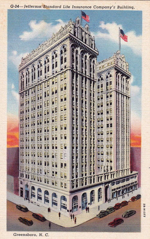
1952-54: "An observation cab was constructed on the Jefferson Standard building in Greensboro making an excellent lookout point." (Building 17 stories high). (Department of Conservation and Development - 16th Biennial Report - 1956)

GREENVILLE
Pitt County - North Carolina Division of Forest Resources

September 15, 1936: The construction of a 99-foot 9-inch steel tower was completed by members of Camp P-67, CCC. (Department of Conservation and Development - 7th Biennial Report - 1938)

1964-66: Due to the expiration of the lease, a new site was acquired and the 100-foot tower was moved. (Department of Conservation and Development - 21st Biennial Report - 1966)

HAMLET
Richmond County - North Carolina Division of Forest Resources
1936-38: The U.S. Resettlement Administration erected a 100-foot steel tower to be transferred to the State under permanent lease at a future date. (Department of Conservation and Development - 7th Biennial Report - 1938)

HARLOWE
Craven County - North Carolina Division of Forest Resources

HARRISVILLE
Montgomery County - North Carolina Forest Service
1944: A 99-foot 9-inch tower was erected by the State. (Department of Conservation and Development - 10th Biennial Report - 1944)

HASSELLMartin County - North Carolina Division of Forest Resources
|

|

HAWSHAW MOUNTAIN
Avery County - North Carolina Division of Forest Resources

1934: A 45-foot 9-inch tower along with a 1-room cabin were built by the CCC. (Department of Conservation and Development - 8th Biennial Report - 1940)

HAYOE BALD
Graham County - Nantahala Forest Service
|
Not dated - (USFS) D.H. Ramsay Library, Special Collections, UNCA
|

HAZEL CREEK
Swain County
December 10, 1956: "S.Sgt. Pete Suteau of McGhee Tyson Air Force Base at Knoxville, Tenn., pilot of a light aircraft last heard from at 11:10 a.m. yesterday, was found uninjured at the Hazel Creek Fire Tower near here (Clingman Dome) today.
A Civil Air Patrol message at 9:05 a.m. reported the sergeant was not injured. His plane apparently crashed in the Great Smoky Mountains.
The message was received here from a Civil Air Patrol radio station set up last night near the top of this peak by two CAP officers, Lt. Harold Medford and Capt. Howard Haskell, both of Shelby, N.C.
The Hazel Creek Fire Tower is about 10 or 12 miles south-southwest of this mountain top and is near the North Carolina-Tennessee boundary." (The Daily Times-News)

HENDERSONVance County - North Carolina Division of Forest Resources
|

|

HIBRITEN MOUNTAIN
Caldwell County - North Carolina Division of Forest Resources
1927: A 35-foot steel tower was erected on Hibriten Mountain. (Department of Conservation and Development of the State of North Carolina - Biennial Report 1926-28)
January 1928: "A 35-foot steel tower on Hibriton Mountain near Lenior, in Caldwell County." (The Forest Worker)
1930-32: A 10 x 12 foot cabin was constructed for the lookout man on duty during fire season. "Cabins will be placed at all towers in isolated locations where it is necessary for the lookout man to remain at the tower for a continued period of fire weather." (Department of Conservation and Development - 4th Biennial Report 1930-32)

HIGH PEAK
Burke County - North Carolina Division of Forest Resources

1934: A 59-foot 3-inch steel tower was erected by the CCC.

HIGH ROCK
Davidson County - North Carolina Division of Forest Resources
October 12, 1954: "There's a tiny glass enclosed cubbyhole atop a 73-foot steel tower on Healing Springs mountain. In this cubbyhole there is a man, armed with field glasses and a two-way radio, who will help to save thousands of dollars for people of Davidson and surrounding Counties in the next few months.
The tower, known as the 'High Rock Tower,' although on Healing Springs mountain, is the first forest fire spotting tower ever erected in Davidson County. Work on the structure started over five weeks ago, but still isn't quite complete. However, the tower was placed in service several days ago because of the extremely dangerous fire situation existing in this area, and it has already proved its value.
The tower was built by Wagner Construction Company, of Salisbury. It took much longer to build than expected, because of the difficulty in blasting hard rock at the base to set up a foundation. It is located on property belonging to J.M. Daniel estate. The property has been leased, along with property over which the road winds, as well as that covered by a power line leading to the tower.
For the past two years much of the fire spotting in this area has been done from atop the city's big water tank, where a telephone has been installed." (The Dispatch)

HIGH ROCKS
Swain County - National Park Service

HILL TOP MOUNTAIN
Haywood County - Pisgah National Forest
January 1928: "A new 30-foot steel tower on Hightop Mountain, near Asheville, will be manned in the near future." (The Forest Worker)

HIGH WINDYBuncombe County - North Carolina Division of Forest Resources
|

|

HILLSBOROUGHOrange County - North Carolina Division of Forest Resources
|

|

HOBUCKEN
Pamlico County - North Carolina Forest Service
1962-64: A new 120-foot steel tower was constructed on a newly acquired site. (Department of Conservation and Development - 20th Biennial Report - 1964)

HOFFMAN
Richmond County - North Carolina Division of Forest Resources
1936-38: The U.S. Resettlement Administration erected a 100-foot steel tower to be transferred to the State at a later date. (Department of Conservation and Development - 7th Biennial Report - 1938)

HOPE MILLS
Cumberland County - North Carolina Division of Forest Resources

HORSE RIDGEBurke County - North Carolina Division of Forest Resources
|

|
December 3, 1928: "The Horse Ridge lookout tower, on the South Mountain protective area in Burke county, which has been completed only within the last month, was also inspected by Mr. Flory, and found to be adequate. It is also a 35 foot steel tower, and is connected by telephone with the Morgantown water shed and the town of Morgantown." (High Point Enterprise)
1928: A 35-foot steel tower was erected 3 miles south of Enola. A wooden cabin has also been built at the base of the tower for the observers living quarters. (Department of Conservation and Development - 3rd Biennium Report 1928-30)
March 12, 1938: "A 10 x 10 foot tower cabin constructed at Horse Ridge tower in Burke County." The work crew were members of the CCC camp P-57. (Department of Conservation and Development - 7th Biennial Report - 1938)

HUNTERSVILLE MOUNTAIN
McDowell County - North Carolina Division of Forest Resources

1940: A 52-foot tower erected by the CCC. (Department of Conservation and Development - 9th Biennial Report - 1942)

ISLAND CREEK
Jones County - Croatan National Forest

JACKSON
Northampton County - North Carolina Division of Forest Resources

1934: A 86-foot 3-inch steel tower erected by the CCC.

JEFFERSONAshe County
|

|

JOANNA BALDGraham/Cherokee County - Nantahala National Forest
|

|

JONES LAKEBladen County - North Carolina Division of Forest Resources
|

|

KELLYS PONDLenoir County - North Carolina Division of Forest Resources
|

|

KILKENNYTyrrell County - North Carolina Division of Forest Resources
|

|

KINSTON
Lenoir County - North Carolina Division of Forest Resources

March 9, 1937: A 99-foot 9-inch steel tower constructed by the CCC. This tower replaced the temporary lookout post atop the Kinston Hotel. Work on the new tower was completed by a crew from Camp S-65. (Department of Conservation and Development - 7th Biennial Report - 1938)

KINSTON HOTEL
Lenoir County
1930-32: A temporary lookout station was posted on the hotel roof. (Department of Conservation and Development - 4th Biennial Report 1930-32)

KNIGHTDALEWake County
|

|

LAGOONBladen County - North Carolina Division of Forest Resources
|

|
August 5, 1937: "It is stated further that there has been approved for construction a 100-foot steel lookout tower near Lagoon. This will complete the tower system and all cost will be borne by the Resettlement Administration." (The Bladen Journal)

December 20, 1937: Members of CCC Camp P-68 completed the construction of the 100-foot steel tower. The tower was purchased by the Resettlement Administration. (Department of Conservation and Development - 7th Biennial Report - 1938)

LEJEUNE, CAMP
Onslow County
September 14, 1951: (Caption with photos) "Fire Watcher-- Five towers have been erected around Camp Lejuene Marine Base where alert watchers are kept on duty to guard against forest fires. Use of live ammunition creates a fire hazard in the adjacent North Carolina woodlands and the Marines are provided to check a blaze at the first alarm.
Dave Willis, of Jacksonville, N.C., one of the watchers, chugs up the long flights of stairs to his 'air-conditioned office.' His is no job for a light-headed man." (Daily Review - Hayward, California)

LICKSTONE MOUNTAIN
Jackson County - U.S. Indian Service

LILES
Halifax County - North Carolina Division of Forest Resources

July 1934: The Civilian Conservation Corps erected a 79-foot 6-inch steel tower.

LILESVILLE
Anson County - North Carolina Division of Forest Resources
1943: A 99-foot 9-inch tower was erected by the State. (Department of Conservation and Development - 10th Biennial Report - 1944)

LINNEY MOUNTAINAlexander County
|

|

LITTLE SCALY
Macon County

LITTLE SNOWBALL
Buncombe County - Big Ivy Historical Society

LOCUST KNOB
Mitchell County - North Carolina Division of Forest Resources

LONG SHOAL
Dare County

LOUISBURGFranklin County - North Carolina Division of Forest Resources
|

|

LOWES GROVE
Durham County - North Carolina Forest Service
1947: A 120-foot tower was erected by the State Forest Service. (Department of Conservation and Development - 12th Biennial Report - 1948)

MACO
Brunswick County - North Carolina Division of Forest Resources

December 1935: The Civilian Conservation Corps constructed a 99-fft 9-inch steel tower at a cost of $1,697.82. The funding for the project was through the Emergency Conservation Works program. (Department of Conservation and Development - 6th Biennial Report 1934-36)
October 5, 1936: A 36 x 36 foot five room dwelling was completed by CCC members from Camp P-62 for the lookout man at Maco Lookout. (Department of Conservation and Development - 7th Biennial Report - 1938)

MAMERS
Harnett County - North Carolina Division of Forest Resources

September 1934: The Civilian Conservation Corps erected a 72-foot 9-inch steel tower and a 2-room tower house for a cost of $990.63. The Emergency Conservation Works program covered the costs of the project with no money coming from the state. (Department of Conservation and Development - 6th Biennial Report 1934-36)

MAXTON
Robeson County - North Carolina Forest Service
1962-64: A new 120-foot steel tower was erected by the State on newly acquired land. (Department of Conservation and Development - 20th Biennial Report - 1964)

MEDOCHalifax County - North Carolina Division of Forest Resources
|

|

MIDWAY
Davidson County

MOORES KNOB
Stokes County - Hanging Rock State Park

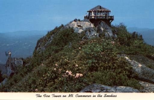
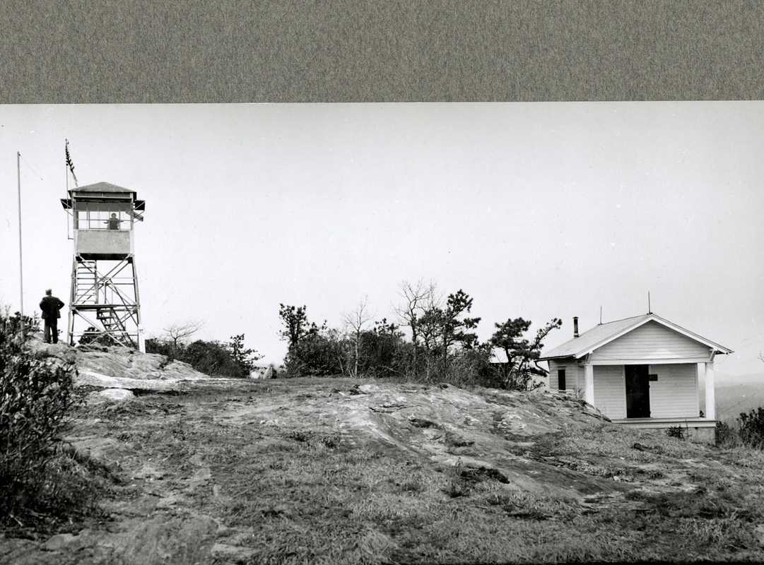
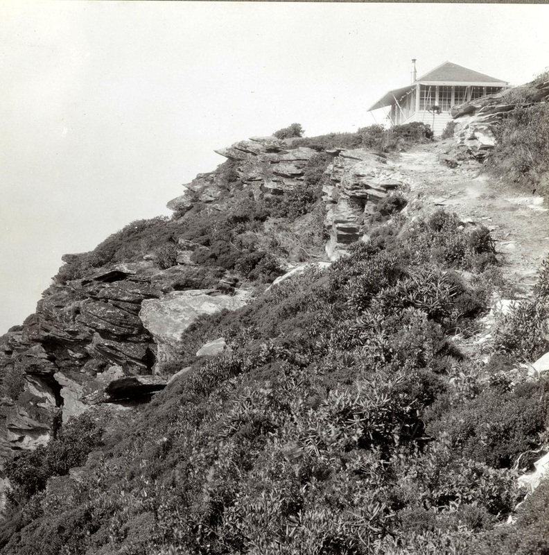
MOUNT CAMMERER(AKA WHITE ROCK OR SHARP TOP)
Haywood County, N.C. / Cocke County, Tenn. - Great Smoky Mountains National Park
|
undated postcard - Ron Kemnow Collection
|
undated image - Creative Commons, fotopedia.com
|


MOUNT MITCHELLYancey County
|

|

MOUNT NOBLE
Swain County - Cherokee Indian Reservation

MOUNT STERLINGHaywood County - Great Smoky Mountains National Park
|

|

MOUNT TIRZAH
Person County - North Carolina Division of Forest Resources
1934: A 72-foot 9-inch steel tower constructed by the CCC.

NAKINA
Columbus County - North Carolina Division of Forest Resources
1931: A 100-foot steel tower with inside stairway and glass enclosed cab was erected 2 miles S.E. of Nakina. (Department of Conservation and Development - 4th Biennial Report 1930-32)

NEBO
Yadkin County - North Carolina Division of Forest Resources

NEWKIRKSampson County - North Carolina Division of Forest Resources
|

|

NEWPORT
Carteret County - U.S. Forest Service

NORFLEET
Bertie County - North Carolina Division of Forest Resources
1926-28: An 80-foot steel tower was erected three miles north of Windsor. (Department of Conservation and Development of North Carolina - Biennial Report 1926-28)
September 1928: "An 80-foot steel lookout tower has been erected by the North Carolina Department of Conservation and Development 1 mile north of Windsor, N.C., on the Stokes Road, one-fourth mile west of State Highway No. 30." (The Forest Worker)
(This may be a different tower than Norfleet)

NORTH CAROLINA BANK AND TRUST COMPANY BUILDING
New Hanover County
1930: "During the spring fire season a temporary map stand worked up by D-4 is being used on the buildings that are serving as temporary lookout points." (Department of Conservation and Development - 3rd Biennial Report 1928-30)

NORTH SAMPSON
Sampson County - North Carolina Division of Forest Resources

November 18, 1937: The CCC constructed a 120-foot creosoted timber tower. (Department of Conservation and Development - 7th Biennial Report - 1938)

ORTON
Brunswick County
1931: 80-foot tower was erected.
November 2005: Staffing of this tower was discontinued.

OTWAYCarteret County - North Carolina Division of Forest Resources
|

|

PALESTINECumberland County - North Carolina Division of Forest Resources
|

|

PANTHER TOP (KNOB)
Cherokee County - Nantahala National Forest
.

1940: A 40-foot steel tower with observation cab was erected by the Civilian Conservation Corps.

PARKTON
Robeson County - North Carolina Division of Forest Resources
1929: A 100-foot steel tower was erected one mile west of Parkton. (Department of Conservation and Development - 3rd Biennial Report 1928-30)
January 16, 1930: "The county now has a 100-foot tower at Parkton." (Robesonian)

PEA RIDGE
Polk County - North Carolina Division of Forest Resources

PELETIER
Carteret County - Croatan National Forest

PEMBROKERobeson County - North Carolina Division of Forest Resources
|

|

PHILLIPS KNOB
Yancey County - North Carolina Forest Service
1943: A 45-foot 9-inch tower was erected by the State. (Department of Conservation and Development - 10th Biennial Report - 1944)

PILOT MOUNTAINTransylvania County
|

|

PINE CLIFF
Craven County

PINK HILL
Duplin County - North Carolina Division of Forest Resources

March 10, 1937: A 99-foot 9-inch steel tower was constructed by a CCC.crew from Camp S-65. (Department of Conservation and Development - 7th Biennial Report - 1938)

PINNACLE (LONG MOUNTAIN)McDowell/Rutherford County - North Carolina Division of Forest Resources
|

|

PITTSBORO
Chatham County - North Carolina Division of Forest Resources

1940: A 100-foot tower was erected by the CCC. (Department of Conservation and Development - 9th Biennial Report - 1942

PLYMOUTH
Washington County - North Carolina Division of Forest Resources

April 1936: The erection of a 99-foot 9-inch steel tower was begun by the Civilian Conservation Corps, the $1,770.21 cost was funded through the Emergency Conservation Works program. (Department of Conservation and Development - 6th Biennial Report 1934-36)
August 13, 1936: The construction of the tower was completed by members of Camp P-67 of the CCC. (Department of Conservation and Development - 7th Biennial Report - 1038)

PORES KNOB
Wilkes County - North Carolina Division of Forest Resources
1929: A 47-foot steel tower was constructed south of Moravian Falls. (Department of Conservation and Development - 3rd Biennial Report 1928-30)

PROCTORVILLERobeson County - North Carolina Division of Forest Resources
|

|

PUNGO
U.S. Fish & Wildlife Service

RAEFORD
Hoke County - North Carolina Division of Forest Resources

REDDITTBeaufort County - North Carolina Division of Forest Resources
|

|

September 25, 1936: A 99-foot 9-inch steel tower completed by members of the CCC from Camp P-67. (Department of Conservation and Development - 7th Biennial Report - 1938)
August 15, 1938: [CCC] "31' x 16' 2-room frame house at Reddit tower in Beaufort County; completed August 15, 1938 by Camp P-67." (Department of Conservation and Development - 8th Biennial Report - 1940)

RENDEZVOUS MOUNTAINWilkes County - Rendezvous Mountain Educational State Forest
|

|

REYNOLDS MOUNTAIN
Buncombe County

RICH MOUNTAINMadison County - Pisgah National Forest
|

|

RICH MOUNTAIN
Transylvania County - North Carolina Division of Forest Resources

February 28, 1939: Erected by the CCC. "40 foot creosoted wood tower observatory, 14 x 14 foot cab, located on Rich Mountain, Transylvania County; erected February 28, 1939 from Camp P-66." (Department of Conservation and Development - 8th Biennial Report - 1940)

RIDDICKSVILLE
Hertford County

RIEGALBrunswick County - North Carolina Division of Forest Resources
|

|

ROARING GAP
Alleghany County - North Carolina Division of Forest Resources

June 1935: The Conservation Corps erected a 59-foot 3-inch steel tower with a 1-room ground cabin at a cost of $963.05. The funding was through the Emergency Conservation Works program. (Department of Conservation and Development - 6th Biennial Report 1934-36)
April 23, 1952: "A woman lookout in a forest fire tower at Roaring Gap died from a fall down the steps of the 59-foot steel structure yesterday.
District Forester F.H. Ledbetter of Lenoir said Mrs. Louis R. Sexton of Roaring Gap fainted as she started to descend the tower. She died about an hour after the fall. Mrs. Sexton had been employed on a temporary basis." (Statesville Daily Record)
District Forester F.H. Ledbetter of Lenoir said Mrs. Louis R. Sexton of Roaring Gap fainted as she started to descend the tower. She died about an hour after the fall. Mrs. Sexton had been employed on a temporary basis." (Statesville Daily Record)

ROCKY KNOB
Caldwell County - U.S. Forest Service

ROCKY POINT
Pender County - North Carolina Division of Forest Resources

1941: A 120 foot tower was erected by the CCC. (Department of Conservation and Development - 9th Biennial Report - 1942)

ROSE HILL
Duplin County - North Carolina Division of Forest Resources

November 1935: A 99-foot 9-inch steel tower was erected by the Civilian Conservation Corps. The $1,630.04 in costs were funded through the Emergency Conservation Works program. (Department of Conservation and Development - 6th Biennial Report 1934-36)
October 22, 1936: A 30 x 36 five room frame house was completed for use as living quarters for the lookout. The work was provided by the members of CCC Camp P-68. (Department of Conservation and Development - 7th Biennial Report - 1938)
1961: The lease on the property expired. The State purchased the property during the summer of this year. (Department of Conservation and Development - 19th Biennial Report - 1962)

ROSEMEADE
Bertie County - North Carolina Forest Service
1948: A 120-foot tower was erected by the State Forest Service. (Department of Conservation and Development - 12th Biennial Report - 1948)

ROUND MOUNTAINNantahala National Forest
|

|

SANATORIUM
Hoke County - North Carolina Division of Forest Resources
1930: "During the spring fire season a temporary map stand worked up by D-4 is being used on the buildings that are serving as temporary lookout points." (Department of Conservation and Development - 3rd Biennial Report 1928-30)

SAND MOUNTAIN
Caldwell County - U.S. Forest Service

SANFORD
Lee County - North Carolina Division of Forest Resources

SASSAFRAS MOUNTAINTransylvania County - North Carolina Division of Forest Resources
|

|

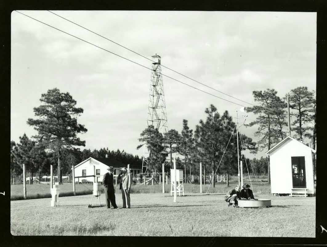
SATULAH MOUNTAIN
Macon County - Nantahala National Forest
|
April 1941 - National Archives (OPA)
|

SCOTLAND
Scotland County - North Carolina Division of Forest Resources

1934: A 72-foot 9-inch steel tower was constructed by the CCC.

SCOTLAND NECK (MOONLIGHT)
Halifax County - North Carolina Division of Forest Resources

1934: A 99-foot 9-inch steel tower erected by the CCC.

SCRANTONHyde County - North Carolina Forest Service
|

|

SCUPPERNONGWashington County - North Carolina Division of Forest Resources
|

|

August 25, 1939: [CCC] "Side Camp P-67--nine enrollees--(house trailers) located near Scuppernong in Washington County. This side camp was established August 25, 1939 for the purpose of erecting a lookout tower. The Side Camp was closed October 27, 1939." (Department of Conservation and Development - 8th Biennial Report - 1940)
October 27, 1939: Erected by the CCC. "120 foot creosoted wood tower with catwalk and inside stairway, located near Scuppernong in Washington County; erected October 27, 1939 from trailer side camp." [The side camp was housed in trailer houses] (Department of Conservation and Development - 8th Biennial Report - 1940)

SHALLOTTEBrunswick County - North Carolina Division of Forest Resources
|

|

SHEFFIELD
Davie County

SHUCKSTACK
Swain County - Great Smoky Mountains National Park
1934: A 60-foot steel International-Derrick tower was erected.

SILER CITY
Chatham County - North Carolina Division of Forest Resources
1947: A 99-foot 9-inch tower was erected by the State Forestry Service. (Department of Conservation and Development - 12th Biennial Report - 1948)

SIMMONSCarteret County - Croatan National Forest
|

|

SMITHFIELD
Johnston County - North Carolina Division of Forest Resources

SNOW HILL
Greene County - North Carolina Division of Forest Resources

1934: A 86-foot 3-inch steel tower constructed by the CCC.

SNOWBALL MOUNTAIN
Buncombe County - Pisgah National Forest
(Also see Little Snowball)

SOUTH MILLSPasquotank County - North Carolina Forest Service
|

|

SOUTHERN PINESMoore County
|

|

SPENCER MOUNTAIN
Gaston County - North Carolina Division of Forest Resources
February 17, 1967: "County Ranger Yates Smith is looking for employees to man the fire tower on Spencer Mountain so that it can be in operation year-round.
The tower, which used to operate year-round, has only been operated three months in the spring and three months in the summer for the past year, Smith said, because of the lack of personnel to man the tower.
Smith said that although the county's fire records show that fire suppression has been good due to the efforts of volunteer fire departments, there is still a need to have the tower in operation year-round." (Gastinia Gazette)

SPIVEY MOUNTAINBuncombe County - North Carolina Division of Forest Resources
|
|
1928: A 35-foot steel tower was erected near Candler. (Department of Conservation and Development - 3rd Biennial Report 1928-30)

SPRUCE MOUNTAIN
Haywood County - Great Smoky Mountains National Park

SPRUCE PINEMitchell County
|

|

STANDING INDIAN BALDMacon County - U.S. Forest Service
|

|

STUMPY POINT
Dare County - North Carolina Division of Forest Resources

October 30, 1939: [CCC] "Side Camp P-68--seven enrollees--(house trailers) located near Stumpy Point, Dare County, from October 30, 1939 through December 20,1939. This side camp was established to erect a lookout tower." (Department of Conservation and Development - 8th Biennial Report - 1940)
December 21, 1939: Erected by the CCC. "120 foot creosoted wood tower with catwalk and inside stairway, located near Stumpy Point in Dare County; erected December 21, 1939 from trailer side camp." [Side camp housed in trailer houses.] (Department of Conservation and Development - 8th Biennial Report - 1940)
1953: A 120-foot Aermotor steel tower was erected to replaced the earlier wood tower.

2009: In the spring the tower was offered for sale by a private party. The tower had been dismantled and packed in a 40-foot shipping container.
2012: The lower half of the tower was re-erected at the Homestake Ranch in Northeast Wyoming where a wood frame cab was added. The top half to be erected at the same land owners property in Minnesota.

SUTTON TOP (MOUNTAIN)
Haywood County - U.S. Forest Service

SWIFT CREEK
Nash County - North Carolina Division of Forest Resources

March 1935: The Civilian Conservation Corps erected a 79-foot 6-inch steel tower and a 2-room ground cabin for $1,221.33. The funding was through the Emergency Conservation Works program. (Department of Conservation and Development - 6th Biennial Report 1934-36)
November 10, 1964: "Bill Lawrence, Nash County Forest Ranger, today announced a new telephone number for the Swift Creek Fire Tower.
The telephone, formerly on the Nashville exchange, is now a Rocky Mount number--GI 2-8444. Forest fires in the area can be reported by calling this tower." (Rocky Mount Evening Telegram)
The telephone, formerly on the Nashville exchange, is now a Rocky Mount number--GI 2-8444. Forest fires in the area can be reported by calling this tower." (Rocky Mount Evening Telegram)

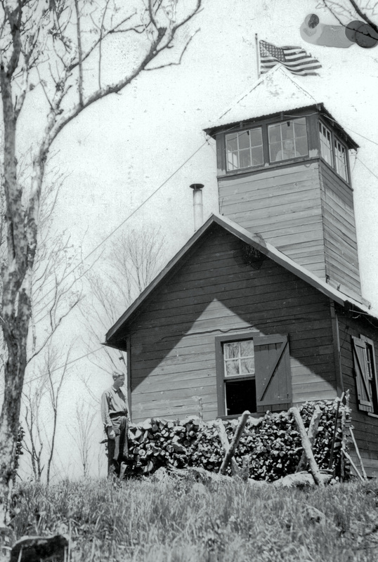
TABLE ROCK MOUNTAIN
Burke County - Pisgah National Forest
|
1937 - National Archives (OPA)
|
1928-30: "Through cooperation with the Pisgah National Forest, a lookout has been placed on Table Rock where no tower has been necessary. A cabin has been erected at the base of the Rock for the shelter of the observer. Six miles of ground circuit line were constructed by the U.S. Forest Service from Jonas Ridge to Table Rock lookout in Burke County. This line will be maintained by us." (Department of Conservation and Development - 3rd Biennial Report 1928-30)
1935: The ECW purchased materials and built a 1-room living quarters for the lookout man. (Department of Conservation and Development - 6th Biennial Report 1934-36)

TEYAHALEE
Graham County - U.S. Forest Service

TOPSAIL
Pender County - North Carolina Division of Forest Resources
|
March 2011 - Creative Commons, Donald Lee Pardue
|


TOXAWAY MOUNTAINJackson / Transylvania Counties - North Carolina Division of Forest Resources
|

|

TROY
Montgomery County - North Carolina Division of Forest Resources

TYRON PEAK
Polk County - North Carolina Division of Forest Resources

July 1934: The Civilian Conservation Corps erected a 45-foot 9-inch steel tower with a 1-room tower cabin at a cost of $873.35. The Emergency Conservation Works program funding the project. (Department of Conservation and Development - 6th Biennial Report 1934-36)

TURNER MOUNTAIN
Surry County

TUSCARORA
Craven County - North Carolina Division of Forest Resources

1934: A 99-foot 9-inch steel tower erected by the CCC.
May 6, 2010: An electrical caused fire broke out in the tower cab when workmen were installing new equipment in the unused tower.

WACCAMAW
Columbus County - North Carolina Division of Forest Resources
1929: A 93-foot steel tower was erected 5 miles north of Wananish. (Department of Conservation and Development - 3rd Biennial Report 1928-30)

WALKER TOP
Burke County - South Mountains State Park

WALLACE
Dupkin County

WARDS CORNER
Pender County - North Carolina Division of Forest Resources

April 1936: A 120-foot steel tower was constructed by the Civilian Conservation Corps, the $2,088.00 cost was funded through the Emergency Conservation Works program. (Department of Conservation and Development - 7th Biennial Report - 1938)
November 16, 1936: The construction of the tower was completed by members of Camp P-68 CCC. (Department of Conservation and Development - 7th Biennial Report - 1938)
May 26, 1937: A 30 x 36 foot five room frame house was completed for use as living quarters for the lookout. Labor was provided through the CCC Camp P-68. (Department of Conservation and Development - 7th Biennial Report - 1938)

WARREN COUNTYWarren County
|

|

WAUCHECHA BALD
Graham County - Nantahala National Forest

WAYAH BALDMacon County - Nantahala National Forest
|

|

WAYNE COUNTY
Wayne County - North Carolina Forest Service
1964-66: A new 120-foot steel tower was erected by the State near Fremont. (Department of Conservation and Development - 21st Biennial Report - 1966)

WAYNE NATIONAL BANK BUILDING
Wayne County - North Carolina Division of Forest Resources
1930: "During the spring fire season a temporary map stand worked up by D-4 is being used on the buildings that are serving as temporary lookout points." (Department of Conservation and Development - 3rd Biennial Report 1928-30)

WENONA
Washington County - North Carolina Division of Forest Resources
1948: A 99-foot 9-inch tower was erected by the State Forest Service. (Department of Conservation and Development - 12th Biennial Report - 1948)

WESSER BALD
Macon County Nantahala National Forest

WHITE OAK
Jones County - U.S. Forest Service

WILLIAMS LAKE
Sampson County - North Carolina Division of Forest Resources

February 6, 1940: [CCC] "Side Camp P-68--eight enrollees--(house trailers) located at Williams Lake, Sampson County, from February 6, 1940 through May 5, 1940. This Side Camp was established for the purpose of constructing a towerman's residence and garage at the Williams Lake lookout tower." (Department of Conservation and Development - 8th Biennial Report - 1940)
April 29, 1940: [CCC] "31' x 25", 4-room frame house at Williams Lake tower in Sampson County; completed April 29, 1940 by Camp S-68." (Department of Conservation and Development - 8th Biennial Report - 1940)

WILMARCraven County - North Carolina Division of Forest Resources
|

|

WILSON
Wilson County - North Carolina Division of Forest Resources

September 1934: The Civilian Conservation Corps erected a 99-foot 9-inch steel tower along with a 2-room tower house at a cost of $1,422.87. The costs were funded through the Emergency Conservation Works program. (Department of Conservation and Development - 6th Biennial Report 1934-36)
1962-64: Due to the expiration of the lease, a new site was acquired and the 100-foot tower moved. (Department of Conservation and Development - 20th Biennial Report - 1964)

WINFALL
Perquimans County - North Carolina Forest Service
1944: A 99-foot 9-inch tower was erected by the State Forest Service with a cooperative with the U.S. Forest Service. (Department of Conservation and Development - 10th Biennial Report - 1944)

WOODS MOUNTAIN
McDowell County - Pisgah National Forest

WOODVILLEBertie County - North Carolina Division of Forest Resources
|

|

YELLOW MOUNTAIN
Macon County - Nantahala National Forest

YOUNG
Johnston County - North Carolina Division of Forest Resources

1936: A 99-foot 9-inch steel tower was erected by the Civilian Conservation Corps, the $1,095.37 cost was funded through the Emergency Conservation Works program. (Department of Conservation and Development - 6th Biennial Report 1934-36)

YOUNGS MOUNTAIN
Rowan County - North Carolina Division of Forest Resources
July 30, 1957: "Valuable radio equipment has been stolen from the fire tower near Cleveland in Rowan County, R.G. Carney, county forester, said today.
Carney said Rowan county officers are investigating the break-in which was discovered earlier this week.
The forester said the tower, which serves parts of Iredale and Rowan counties, was not manned except during the danger seasons and it was impossible to determine the actual time of entry. However, Carney said, all indications point to a recent break-in.
Carney said the lock was prized and broken, and only the radio equipment was taken. Other equipment was not tampered with, he said.
The fire danger seasons are in the fall and in the spring and before the tower can be effective again the equipment will have to be replaced, Carney said. This replacement will work a hardship on his department, he explained, since no provisions were made for more equipment in the budget." (Statesville Record and Landmark)

MISC. NOTES - NORTH CAROLINA |

|
